Laitlum Canyons: Where The Earth Touches The Sky

Laitlum Canyons
Laitlum Canyons
Laitlum Canyons
Audio
SoundHelix-Song-1.mp3
0:00 / 0:00

Meghalaya's Dramatic Amphitheater at the End of Hills

By Shillong.com Research Desk | January 2026


Introduction: The Edge of the World

Perched at an altitude of over 2,400 feet in the East Khasi Hills, Laitlum Canyons is where Meghalaya reveals one of its most dramatic secrets. The name Laitlum translates to "end of hills" in the Khasi language—a fitting description for this breathtaking amphitheater where rolling green valleys plunge into misty gorges and layers of mountains cascade endlessly toward the horizon.

Located just 21–25 km from Shillong (about 45 minutes to an hour by road), Laitlum has emerged as one of Northeast India's most photogenic yet underrated destinations. Unlike its more famous counterparts in Cherrapunji, Laitlum remains relatively uncrowded, offering visitors an almost meditative encounter with raw, untouched beauty.


Why Laitlum is Special: A 360° Vista Unlike Any Other

Laitlum isn't just a viewpoint—it's an experience of spatial infinity. Standing at the canyon's edge, you'll find yourself surrounded by:

  • Endless Panoramas: 360-degree views of deep valleys, terraced hillsides, and verdant gorges stretching into Bangladesh on clear days.
  • Clouds Below Your Feet: During winter mornings and post-monsoon evenings, clouds often settle in the valleys below, creating the illusion of standing above heaven itself.
  • Dramatic Cliffs & Meadows: The contrast between sheer cliff faces and gentle grassy slopes creates a striking visual drama perfect for photography.
  • Ethereal Silence: Unlike crowded tourist spots, Laitlum offers profound quiet—only the whisper of wind and distant bird calls.

According to the official Meghalaya Tourism page, "Laitlum Canyon opens up to vast, dramatic landscapes where steep cliffs drop into deep valleys and layers of hills stretch endlessly into the horizon."


Visitor Testimonials: Voices from the Edge

Recent Traveler Reviews (2024–2026):

🌟 TripAdvisor Review (2026):
"Laitlum canyons is one of the best places to visit in Shillong. It feels that you are in the heavens. Clouds are nearby you and you are in clouds—must visit if you love valleys and mountain views."
TripAdvisor

🌟 Wanderlog Testimonial (November 2025):
"My visit to Laitlum Canyons was an absolutely unforgettable experience! I was completely mesmerized by the view from the moment I arrived. The stunning vistas and serene atmosphere made it a perfect escape from the hustle and bustle."
Wanderlog

🌟 Instagram Post (May 2025):
"Had the privilege of visiting the stunning Laitlum Canyon... The warmth and hospitality of the people truly stood out—their friendliness and helpful nature made the visit even more memorable."
Instagram

🌟 MakeMyTrip Description:
"Visitors have described it as a beautiful and eye-soothing location, often likening the experience to being in heaven due to the panoramic views."
MakeMyTrip

Critical Note (2026):
Some reviewers mention increasing construction activity and littering of plastic bottles, signaling the need for responsible tourism and stricter conservation measures.


Getting There: Access and Logistics

Location & Distances:

  • From Shillong: 21–25 km; 45 minutes to 1 hour by road
  • From Guwahati: ~130 km; approximately 3 hours
  • From Shillong Airport: 33 km
  • Nearest Major Village: Smit (6–8 km away; 15-minute drive)

How to Reach:

Since there are no direct buses to Laitlum, the best options are:

  1. Taxi from Shillong: Hire from Police Bazar or any local stand

    • Round trip: ₹2,500–₹3,500
    • Half-day tour package: Often includes nearby Smit Village
  2. Self-Drive/Bike Rental: The road is well-maintained and scenic; ideal for adventure enthusiasts.

  3. Day Tours: Many travel agencies in Shillong offer Laitlum as part of East Khasi Hills circuits.

Route: Shillong → Smit Village → Laitlum Canyons (well-paved NH road; clear signage)


Entry Fees & Timings (2025–2026)

  • Entry Fee: ₹20–₹50 per person (suggested donation; some reports indicate no mandatory fee)
  • Parking: ₹50 (two-wheelers and cars)
  • Timings: 5:00 AM – 5:30 PM (best to leave well before 5 PM for safety)
  • Best Viewing Hours:
    • Sunrise: 5:00–7:00 AM (golden light, fewer crowds, misty valleys)
    • Late Morning: 10:00–11:00 AM (clear skies, reduced fog)
    • Sunset: 4:00–5:00 PM (dramatic light; ensure you leave with daylight)

Sources: MakeMyTrip, Wanderlog


Trekking Trails: From Viewpoint to Village

Laitlum offers two distinct experiences:

1. Viewpoint Experience (2–3 Hours)

Perfect for families, casual visitors, and photographers:

  • Stay at the upper viewpoint
  • Walk along the grassy cliff edges
  • Enjoy tea and snacks at the small shop
  • Minimal physical exertion
  • Suitable for all ages

2. Canyon Valley Trek (5–6 Hours)

For adventure seekers and serious trekkers:

  • Duration: Full day activity
  • Distance: Descent into the valley and back (steep trail)
  • Difficulty: Moderate to challenging
  • Highlights: Trek through dense forests, cross streams, visit a remote Khasi village at the canyon's base
  • Guide Fee: ₹200–₹300 (highly recommended)

Safety Tips:

  • Avoid monsoon treks: Trails become slippery and dangerous
  • Start early: Must return before 5 PM (no lighting on trails)
  • Footwear: Sturdy trekking shoes with good grip
  • Hydration: Carry at least 2 liters of water
  • Group travel: Never trek alone; inform someone of your plans

According to TripAdvisor trekkers (2026): "Start a bit early, avoid unnecessary load, carry sufficient water, take enough rest stops, move in a group and never leave anyone behind."


Best Time to Visit: Seasonal Guide

🌤️ Peak Season: October to March (15°C–25°C)

  • Why: Clear skies, excellent visibility, pleasant weather
  • Highlights: Best for photography, long-distance views extend to Bangladesh plains
  • Crowds: Moderate (still less crowded than Cherrapunji)
  • What to Expect: Crisp mornings with mist; sunny afternoons; clouds often settle below the viewpoint

Official Recommendation: "The best season to visit Laitlum Canyons is from October to May when the weather is pleasant and the skies are clear."
Indian Holiday

🌸 Shoulder Season: April–May

  • Warmer weather: 20°C–30°C
  • Pre-monsoon showers: Light, occasional
  • Advantage: Lush greenery beginning; fewer tourists
  • Note: Mornings can be misty; visibility improves by midday

🌧️ Monsoon Season: June–September (CAUTION)

  • Rainfall: Heavy; trails slippery
  • Visibility: Limited due to thick fog
  • Safety Risk: Dangerous for trekking into the valley
  • Best for: Atmospheric, moody photography; dramatic cloud formations
  • Not Recommended For: First-time visitors, families with children, serious trekkers

Expert Warning: "Beginners are advised not to undertake the journey during monsoon as the trail gets slippery and dangerous."
Hotel Polo Towers


What to Bring: Essential Packing List

Clothing & Gear:

  • ✅ Layered clothing (mornings can be cold even in summer)
  • ✅ Windbreaker or light jacket (winds intensify at the edge)
  • ✅ Sturdy trekking shoes (essential for valley trek)
  • ✅ Hat and sunglasses (strong UV exposure at altitude)
  • ✅ Extra socks (if trekking)

Supplies:

  • ✅ 2–3 liters of water
  • ✅ High-energy snacks (limited food options on-site)
  • ✅ Sunscreen (SPF 50+)
  • ✅ Insect repellent (especially during warmer months)

Photography:

  • ✅ Wide-angle lens (for panoramic shots)
  • ✅ Polarizing filter (reduces haze)
  • ✅ Tripod (for sunrise/sunset shots)
  • ✅ Extra batteries (cold drains power faster)

Other:

  • ✅ Cash (no ATMs nearby; small shop accepts only cash)
  • ✅ First-aid kit
  • ✅ Portable charger
  • ✅ Reusable water bottle (avoid single-use plastics)

Photography Tips: Capturing the Edge

🌅 Best Light Conditions:

  • Golden Hour: Sunrise (5:30–7:00 AM) and late afternoon (4:00–5:00 PM)
  • Midday: 11:00 AM–2:00 PM (best for clear, haze-free shots when clouds part)

📷 Composition Ideas:

  • Wide panoramas capturing valley layers
  • Silhouette shots against cloud formations
  • Close-ups of cliff-edge grasses with valley backdrop
  • Time-lapse of clouds moving through gorges

Pro Tip: "The dramatic cliffs and meadows create a striking contrast, while the peaceful surroundings make it an ideal escape... a haven for photographers."
Meghalaya Tourism


Nearby Attractions: Extending Your Trip

1. Smit Village (6–8 km away)

  • Highlight: Traditional Khasi village; home to the Ling Shaad (traditional Khasi house)
  • Cultural Significance: Hosts the Nongkrem Dance Festival (November)
  • Time: 1–2 hours

2. Rasong (Village Below Laitlum)

  • For: Trekkers descending into the canyon
  • Experience: Authentic Khasi homestays; remote village life

3. Shillong City (25 km)

  • Combine Laitlum with Police Bazar, Ward's Lake, Cathedral of Mary Help of Christians

4. Elephant Falls (27 km from Laitlum)

  • Classic waterfall stop on the way back to Shillong

5. Mawphlang Sacred Forest (30 km)

  • Ancient sacred grove; pair with Laitlum for a full-day nature immersion

Suggested Itinerary:
Shillong (start early 5 AM) → Laitlum Sunrise (5:30–8:00 AM) → Smit Village (9:00–10:30 AM) → Mawphlang Sacred Forest (11:00 AM–1:00 PM) → Return to Shillong via Elephant Falls


Accommodation Options

Near Laitlum:

  • Limited accommodation directly at Laitlum
  • Basic guesthouses in Smit Village: ₹800–₹1,500/night

In Shillong (25 km away):

  • Budget: ₹800–₹1,500/night (Police Bazar area hostels, guesthouses)
  • Mid-Range: ₹2,500–₹5,000/night (hotels near Ward's Lake, Polo Grounds)
  • Premium: ₹6,000–₹15,000/night (Ri Kynjai, Vivanta Meghalaya)

For Valley Trekkers:

  • Homestays in Rasong Village (at canyon base): ₹500–₹1,000/night; advance booking required

Sources: TripAdvisor Hotels Near Laitlum


On-Site Facilities

Available:

  • Small tea/snack shop (Maggi, chai, biscuits)
  • Parking area
  • Basic restrooms
  • Children's play area (slides, swings)
  • Horse rides (₹100–₹200; availability varies)

Not Available:

  • Restaurants (bring your own food)
  • ATMs
  • First-aid station (carry your own kit)

Responsible Tourism: Protecting the Edge

With increasing visitor numbers, Laitlum faces environmental pressure:

Do's:

  • ✅ Use reusable water bottles
  • ✅ Carry all trash back with you
  • ✅ Stay on marked trails
  • ✅ Support local shops and guides
  • ✅ Respect cliff edges (no barriers in many areas)

Don'ts:

  • ❌ No littering (plastic bottles are a growing problem)
  • ❌ No loud music (preserve the silence)
  • ❌ No campfires (fire risk)
  • ❌ Don't venture too close to cliff edges (especially in fog)

2026 Concern: Recent reviews highlight construction activity and plastic waste accumulation—please practice leave-no-trace principles.


Verdict: Is Laitlum Worth It?

⭐ Overall Rating: 4.5/5

Best For:

  • Nature lovers seeking solitude
  • Photographers (landscape, travel)
  • Adventure trekkers (valley descent)
  • Couples and solo travelers
  • Sunrise/sunset chasers

Not Ideal For:

  • Those expecting built infrastructure
  • Visitors during heavy monsoon (June–August)
  • People uncomfortable with cliff edges

Time Recommendation:

  • Viewpoint visit: 2–3 hours
  • Valley trek: Full day (5–6 hours)

Final Thought:
Laitlum Canyons is Meghalaya's answer to the question, "Where does the earth meet the sky?" It's a place where silence speaks, where clouds become your companions, and where the simple act of standing still becomes a profound meditation on nature's grandeur.


Practical Itinerary Suggestions

Half-Day Trip (Sunrise Special):

  • 4:30 AM: Leave Shillong
  • 5:30 AM: Arrive Laitlum (sunrise)
  • 5:30–8:00 AM: Photography, tea, exploration
  • 8:30 AM: Return to Shillong

Full-Day Adventure:

  • 5:00 AM: Leave Shillong
  • 5:30 AM: Sunrise at Laitlum
  • 7:30 AM: Begin valley trek (with guide)
  • 12:00 PM: Lunch in Rasong Village
  • 2:00 PM: Trek back up
  • 4:00 PM: Return to Shillong

Multi-Attraction Day:

  • 6:00 AM: Laitlum sunrise
  • 9:00 AM: Smit Village
  • 11:00 AM: Mawphlang Sacred Forest
  • 2:00 PM: Lunch in Shillong
  • 3:00 PM: Elephant Falls
  • 5:00 PM: Return

Key Takeaways

✔️ Name Meaning: Laitlum = "End of Hills" in Khasi
✔️ Distance from Shillong: 21–25 km (45–60 minutes)
✔️ Altitude: ~2,400 feet
✔️ Entry: ₹20–₹50 (donation); Parking ₹50
✔️ Best Time: October–March (peak); April–May (good); Avoid June–September for trekking
✔️ Time Needed: 2–3 hours (viewpoint); 5–6 hours (valley trek)
✔️ Difficulty: Easy (viewpoint); Moderate-Challenging (trek)
✔️ Safety: No barriers on cliffs; avoid monsoon treks; return before 5 PM


For More Information

📍 GPS Coordinates: Approximately 25.4507° N, 91.8432° E
🌐 Official Resources:

📞 Contact for Guides & Bookings: Visit www.shillong.com for detailed itineraries, local guides, weather updates, and real-time trail conditions.

Location
Highlight
No

Krang Suri Falls: Meghalaya's Turquoise Swimming Paradise (Updated: 2026)

Krang Suri Falls
Krang Suri Falls
Krang Suri Falls
Audio
SoundHelix-Song-1.mp3
0:00 / 0:00

Amlarem Village, West Jaintia Hills | 87 km from Shillong

By Shillong.com Research Desk | January 2026


Some waterfalls command respect from a distance. Others invite you to dive in. Krang Suri Falls belongs firmly to the latter category. With water so impossibly turquoise it looks Photoshopped, a natural infinity pool perfect for swimming, and accessibility that doesn't require mountaineering skills, this West Jaintia Hills gem has rapidly become Meghalaya's most Instagram-famous waterfall—and for once, the hype is justified.

Unlike the dramatic plunges of Nohkalikai or the architectural marvel of living root bridges, Krang Suri offers something simpler but equally valuable: pure, uninhibited joy. The kind that comes from plunging into cool, mineral-rich water on a hot afternoon, surrounded by limestone cliffs and dense forest, while a waterfall roars just meters away.

THE TURQUOISE PHENOMENON: SCIENCE BEHIND THE SPECTACLE

The first question every visitor asks: "Is that water color real?" The answer is yes—and it's the result of fascinating geological chemistry.

Krang Suri's signature electric blue-green hue comes from high concentrations of dissolved limestone minerals in the water. As the Lukha River flows through the limestone-rich terrain of the Jaintia Hills, calcium carbonate and other minerals dissolve into the water. When sunlight penetrates the clear water and reflects off the white limestone riverbed, it creates that otherworldly turquoise glow.

A Facebook post from 2020 explained: "The fascinating blue color of the water is best seen after the monsoons or in Dec-Jan. Color of water changes with season" Facebook. During peak monsoon, the water runs muddier; post-monsoon, as sediment settles and sunlight strengthens, the turquoise effect reaches its zenith.

According to Meghalaya Tourism's official description: "The clear blue waters of the falls are at their most vibrant between October and May, when the weather is pleasant and water clarity is optimal" Meghalaya Tourism.

LOCATION & ACCESSIBILITY: THE EASY-TO-REACH GEM

Geographic Details:

  • District: West Jaintia Hills
  • Nearest Village: Amlarem
  • Distance from Shillong: 87-90 km (2.5-3 hours drive)
  • Distance from Jowai: 29 km (1 hour)
  • Distance from Dawki: 31 km (1 hour)
  • Nearest Airport: Guwahati (approximately 170 km, 4-5 hours)

How to Reach:

From Shillong, the journey takes you through Jowai via well-maintained roads. As a 2025 Tripoto guide noted: "The distance between Shillong and Krang Suri Waterfalls is about 90 km and it takes about 2.5 hours to cover it by car. You can either hire a taxi or drive your own vehicle" Tripoto.

Transport Options:

  • Private Taxi from Shillong: ₹2,500-3,500 round trip
  • Shared Taxi to Jowai: ₹150-200 per person, then local transport to falls (₹300-500)
  • Self-Drive: Excellent road conditions, GPS-friendly route
  • Day Tour Packages: ₹1,200-2,000 per person (including transport and guide)

Once you reach the parking area, it's a manageable 150-200 steps down to the waterfall—significantly easier than most Meghalaya treks. A TripAdvisor reviewer in 2025 noted: "The waterfall is easy to reach, just 20 minutes of climbing down staircases which are well built" TripAdvisor.

ENTRY FEES & FACILITIES (2025-2026)

Current Fee Structure:

  • Entry Fee: ₹50-60 per person (Indians); ₹100 (foreigners)
  • Parking: ₹20 for two-wheelers; ₹50 for cars
  • Life Jackets: ₹50 rental (mandatory for swimming in deeper areas)
  • Lockers: ₹20-30 (available at changing rooms)
  • Camera/Photography: Included in entry fee

Operating Hours: 7:00 AM - 6:00 PM daily (best to visit 9 AM - 5 PM)

Facilities Available (2025 Upgrades):

According to recent visitor reviews, infrastructure has significantly improved. A TripAdvisor reviewer in 2025 observed: "There has been a lot of improvement of the approach to the down side of the falls compared to last visit. Changing rooms and toilets are in place and neat and hygienic" TripAdvisor.

Current Amenities:

  • Clean, well-maintained changing rooms (separate for men and women)
  • Western-style toilets (maintained regularly)
  • Life jacket rental station with trained attendants
  • Small shops selling snacks, beverages, and basic supplies
  • Designated picnic areas with benches
  • Security guards/lifeguards on duty
  • First aid facilities
  • Guest houses for overnight stays (recently added)

THE SWIMMING EXPERIENCE: WHAT TO EXPECT

Krang Suri's main attraction is its swimmable natural pool—a rarity among Meghalaya's waterfalls.

Pool Characteristics:

  • Depth: Varies from 3 feet (wading area) to 10-12 feet (deep section)
  • Temperature: Cool but not freezing (approximately 20-22°C year-round)
  • Water Quality: Crystal clear, mineral-rich, safe for swimming
  • Current: Gentle in most areas; stronger near the waterfall impact zone

A 2026 TripAdvisor reviewer enthusiastically described: "Facilities & Entry: The falls has an entry charge of ₹60 per person and no parking fees. Life jackets are mandatory if you want to swim (Trust me, you want to!). Swimming in the blue water plunge pool is sooooo refreshing and a pleasant experience" TripAdvisor.

Safety Measures:

A Travel Triangle guide from 2024 emphasized: "The pool can be deep in certain areas, so wearing a life jacket is recommended, especially for inexperienced swimmers. Life jackets are usually available for rent at the site" Travel Triangle.

Swimming Guidelines:

  • Life jackets mandatory for non-swimmers
  • Children must be supervised at all times
  • Avoid jumping from rocks (not officially permitted)
  • Stay away from the waterfall impact zone (strong current)
  • Don't swim during heavy rain or if water appears murky
  • Follow lifeguard instructions

BEST TIME TO VISIT: SEASONAL GUIDE

Peak Season (October - March):

According to Meghalaya Tourism: "The best time to visit Krangshuri Falls is between October and May, when the weather is pleasant and the clear blue waters of the falls are at their most vibrant" Meghalaya Tourism.

A 2025 TripAdvisor reviewer advised: "Best Time: I would suggest Late October to Early March as the best time to Visit this place. Sunny skies are a bonus" TripAdvisor.

Why This Period is Ideal:

  • Water at its clearest and most turquoise
  • Comfortable temperatures (15-25°C)
  • Lower water levels = safer swimming
  • Sunny days enhance the blue color
  • Steps are dry and safe

Shoulder Season (April - May):

  • Warmer weather (25-32°C)
  • Still clear water but increasing flow
  • Good for swimming (refreshingly cool)
  • Fewer crowds than winter

Monsoon Season (June - September):

A Just Wravel guide noted: "Those with an intense love for the moody rainy season can still enjoy the waterfalls during monsoons, but must exercise extreme caution as trails can be slippery" Just Wravel.

Monsoon Considerations:

  • Waterfall at maximum force (spectacular but dangerous)
  • Water becomes muddy brown (loses turquoise color)
  • Swimming often prohibited due to strong currents
  • Steps can be extremely slippery
  • Increased leech activity on trails
  • Heavy rainfall can close access temporarily

VISITOR TESTIMONIALS: REAL EXPERIENCES

An Instagram traveler in July 2025 shared: "My visit to Krang Suri Waterfall in Meghalaya was a refreshing escape. The turquoise water pool, surrounding greenery, and peaceful atmosphere made it unforgettable" Instagram.

A February 2025 Facebook post enthusiastically declared: "Following are the reasons for my choice: 1. The waterfall is easy to reach, just 20 minutes of climbing down staircases which are well built. 2. The greenish blue base with crystal clear water is mesmerizing. 3. Life jackets are available. 4. Very clean washroom and changing room facilities" Facebook.

A 2026 TripAdvisor reviewer observed: "This is one of the Best tourist spot in Shillong. Since Cherrapunjee is a common and crowded place now a days, so people are searching for alternatives. And Krang Suri Falls is definitely the best alternative" TripAdvisor.

Another visitor wrote: "Krang suri Falls is well developed tourist spot. Among all the spots i visited, i felt this was the most romantic. A serene feeling comes over u at that place" TripAdvisor.

THE LEGEND: FOLKLORE BEHIND THE NAME

According to local Jaintia folklore, the waterfall's name comes from a poignant love story. A young boy named Krang Suri used to pick oranges in a garden near his house. One day, he encountered a beautiful lady picking oranges in the same grove. Enchanted, he began visiting the spot regularly, hoping to see her again, though he never spoke to her.

The story symbolizes unfulfilled longing and the bittersweet beauty of unrequited love—themes that resonate with the waterfall's serene yet melancholic atmosphere eMeghalaya.

PRACTICAL TIPS FOR VISITORS

What to Bring:

  • Swimwear (wear underneath regular clothes for convenience)
  • Extra set of dry clothes
  • Waterproof bag for phone and valuables
  • Towel
  • Sunscreen (waterproof formula)
  • Water shoes or sandals with grip (rocks can be slippery)
  • Snacks and water
  • Small first-aid kit
  • Cash (card facilities limited)

What NOT to Bring:

  • Glass bottles (plastic only)
  • Single-use plastics (eco-friendly policy)
  • Expensive jewelry
  • Expectations of complete solitude (it's popular!)

Photography Tips:

  • Visit between 11 AM - 2 PM for best light on the water
  • Sunny days produce the most vibrant turquoise color
  • Use polarizing filter to reduce glare and enhance blue
  • Wide-angle lens captures the full pool and waterfall
  • Waterproof camera/housing for underwater shots

Time Required:

  • Minimum: 2-3 hours (includes swimming time)
  • Recommended: 3-4 hours (for relaxed experience)
  • With nearby attractions: Full day

NEARBY ATTRACTIONS: COMBINING YOUR VISIT

Within 30 km:

  • Thadlaskein Lake: 25 km (serene lake with historical significance)
  • Nartiang Monoliths: 40 km (ancient megalithic stones)
  • Phe Phe Falls: 15 km (another scenic waterfall)

Within 50 km:

  • Dawki & Umngot River: 31 km (crystal-clear river, boating)
  • Mawlynnong Village: 60 km (Asia's cleanest village)

ACCOMMODATION OPTIONS

Near Krang Suri:

  • Basic guest houses at the falls (recently opened): ₹800-1,200/night
  • Limited homestays in Amlarem village: ₹500-800/night

Jowai (29 km away):

  • Budget hotels: ₹800-1,500/night
  • Mid-range hotels: ₹2,000-3,500/night

Shillong (87 km away):

  • Full range of accommodation from budget to luxury
  • Better dining and amenities

THE VERDICT

Krang Suri Falls represents Meghalaya tourism at its most accessible and joyful. Unlike treks that test endurance or viewpoints that demand only passive observation, Krang Suri invites active participation. It's a waterfall you don't just photograph—you immerse yourself in, literally.

The improved infrastructure has made it family-friendly without sacrificing natural beauty. Clean facilities, safety measures, and easy access mean even elderly visitors or those with young children can enjoy this natural wonder. Yet it retains enough raw beauty to satisfy adventure seekers and nature purists.

Is it becoming touristy? Yes. Does that diminish the experience? Surprisingly, no. The turquoise water remains as stunning, the swimming as refreshing, and the setting as picturesque as when it was relatively unknown. Sometimes, places become popular precisely because they deliver exactly what they promise—and Krang Suri consistently delivers.

For travelers seeking that perfect blend of natural beauty, adventure, and comfort, where you can swim in a postcard-perfect setting without roughing it in the wild, Krang Suri hits the sweet spot.

Recommended For: Families, couples, friend groups, photography enthusiasts, swimmers, anyone seeking accessible natural beauty

Not Ideal For: Solitude seekers (it's popular!), monsoon adventurers (swimming restricted), those expecting untouched wilderness

Overall Rating: 4.5/5 stars - One of Meghalaya's most visitor-friendly natural attractions


For detailed itineraries, weather updates, and booking assistance, visit www.shillong.com

Location
Highlight
No

Living Root Bridges: Where Nature and Human Ingenuity Grow as One

Living Root Bridges
Living Root Bridges
Living Root Bridges
Audio
SoundHelix-Song-1.mp3
0:00 / 0:00

Jingkieng Jri | Khasi & Jaintia Hills, Meghalaya


In an age of concrete and steel, where architecture seeks to conquer nature, the Khasi and Jaintia peoples of Meghalaya have spent centuries practicing a different philosophy: collaboration. Their living root bridges—locally called Jingkieng Jri—are not built but grown, not constructed but nurtured. These extraordinary structures represent perhaps humanity's most patient architectural achievement, where a bridge can take 15 years to become functional and 500 years to reach full maturity.

Walking across one feels less like crossing a man-made structure and more like being embraced by a living organism—because that's precisely what it is. As your feet touch the interwoven roots, moss-covered and pulsing with life, you're experiencing bio-engineering that predates modern sustainability concepts by centuries, yet surpasses most contemporary green architecture in both elegance and effectiveness.

THE SCIENCE OF GROWING BRIDGES: INDIGENOUS BIO-ENGINEERING

Living root bridges are created using the aerial roots of the rubber fig tree (Ficus elastica), a species uniquely suited to Meghalaya's subtropical monsoon climate. These trees produce secondary roots from their branches that grow downward, seeking soil and nutrients—roots that the Khasi people recognized could be guided, trained, and ultimately woven into functional structures.

According to a 2019 pilot study published in Nature Scientific Reports, these bridges demonstrate remarkable structural properties: "Living Root Bridges (LRBs) in the Indian State Meghalaya are grown with aerial roots of Ficus elastica... representing unique bio-engineering solutions that strengthen over time rather than deteriorate" Nature.

The Traditional Construction Process:

  1. Tree Selection & Planting: Rubber fig trees are planted on both riverbanks, or existing trees are selected for their robust aerial root production.

  2. Scaffolding Creation: Hollowed-out betel nut tree trunks or bamboo poles are positioned across the stream as temporary guides.

  3. Root Training: Young, flexible aerial roots (typically 3-5 years old) are carefully threaded through the hollow trunks or tied to bamboo scaffolding.

  4. Weaving & Binding: As roots reach the opposite bank, they're interwoven with each other and anchored into the soil, creating a mesh-like structure.

  5. Growth & Strengthening: Over 15-20 years, the roots thicken, intertwine more densely, and fuse together through a process called inosculation Living Root Bridges.

  6. Maturation: The bridge continues strengthening for decades or centuries, with some bridges estimated to be over 500 years old.

As a BBC Future article noted in 2021: "In a method perfected over centuries, the Khasi bridge builders weave aerial roots onto a bamboo or another wooden scaffolding, wheedle them across rivers, and train them to take root on the other bank" BBC.

Why They Work:

  • Self-Strengthening: Unlike conventional bridges that deteriorate, living root bridges grow stronger with age
  • Monsoon-Proof: The living structure flexes with water flow rather than resisting it
  • Self-Repairing: Damaged sections naturally regenerate
  • Load-Bearing: Mature bridges can support 50+ people simultaneously
  • Longevity: Potential lifespan of 500+ years with minimal maintenance

FAMOUS BRIDGES: WHERE TO EXPERIENCE THIS MARVEL

There are approximately 11 functional living root bridges scattered across Meghalaya, primarily in the East Khasi Hills and West Jaintia Hills districts India Lost and Found Blog.

1. Umshiang Double-Decker Root Bridge, Nongriat

The crown jewel and most famous of all living root bridges, this two-tiered structure stands at 2,400 feet elevation near Cherrapunji.

Key Facts:

  • Age: Estimated 180+ years old
  • Structure: Two functional bridges stacked vertically
  • Upper Bridge: 20 meters long
  • Lower Bridge: Fully developed crossing
  • Trek Distance: 3 km one way
  • Steps: Approximately 3,000-3,500 (descent and ascent)
  • Trek Duration: 3-5 hours round trip
  • Difficulty: Moderate to challenging

Trek Details:

A 2025 trekker described the experience: "The trek involves a total climb of around 3000 steps one-way. It is not a trail, but steps all the way. You have to climb down to the river and then climb up on the other side" Facebook - Adventure Group.

According to Just Wravel's 2025 guide: "The trek to the Double Decker Living Root Bridge is approximately 3 km (one way), with a steep descent and climb of over 3,000 steps. While the path is well-marked, the trek is considered moderate to challenging, requiring good stamina and comfortable footwear" Just Wravel.

What to Expect:

  • First 2,000 steps are steep descent through dense forest
  • Multiple rest points with small shops selling tea, Maggi, and snacks
  • Single-decker root bridge appears after approximately 1.5 hours
  • Double-decker bridge requires additional 30-45 minutes
  • Optional extension: Rainbow Falls (additional 1 hour trek)

Entry & Fees:

  • Entry: ₹50 per person
  • Guides: ₹300-500 (optional but recommended for first-timers)
  • Closed on Sundays (including Rainbow Falls)
  • Best Time: October to March (avoid monsoons when steps become treacherous)

A TripAdvisor reviewer in 2025 noted: "The hike to the double dekker root bridge was a fun and beautiful experience on my 5-day travels through Meghalaya! We took the challenge to include the Rainbow Falls. You can get food and fresh lemon juice along the trek, which especially helps completing the 3500 steps from the double dekker root bridge back to the start" TripAdvisor.

Overnight Option: Nongriat village offers basic homestays (₹400-800 per night) allowing you to experience village life and tackle the return climb with fresh legs.

2. Riwai Living Root Bridge (Near Mawlynnong)

A far more accessible option, this single-decker bridge near Asia's cleanest village offers a gentler introduction to living root bridge experiences.

Key Facts:

  • Location: 3 km from Mawlynnong village, 90 km from Shillong
  • Trek Distance: Approximately 1 km (15-20 minutes)
  • Difficulty: Easy to moderate
  • Structure: 17-meter-long single-decker bridge
  • Best Combined With: Mawlynnong village tour

A TripAdvisor reviewer shared: "It is beautiful and easily accessible. Around a 15-minute trek, like everywhere else in Meghalaya, you climb down the steps first to reach the bridge, and then climb back up" TripAdvisor.

Perfect For: Families, elderly travelers, or those wanting the experience without extreme physical exertion.

3. Wah Myor Living Root Bridge

Recently gaining attention as one of Meghalaya's highest living root bridges.

Key Facts:

  • Location: Near Krohiawhiar village
  • Trek: 2-hour downhill through dense forest
  • Unique Feature: Towers high above the river
  • Difficulty: Moderate

An Instagram post from December 2025 described it: "It's a moderate two hour downhill hike through dense forest before the bridge finally comes into sight. The bridge towers high above the river" Instagram.

4. Other Notable Bridges:

  • Rangthylliang Root Bridge: Near Pynursla
  • Mawkyrnot Living Root Bridge: Described as "exhilarating yet peaceful" in dense forest settings
  • Kudengrim Root Bridge: Traditional Khasi construction

VISITOR TESTIMONIALS: REAL EXPERIENCES

A Medium blogger in 2020 reflected: "It took us nearly 3 hours to reach the location. It was a calm and peaceful place, surrounded by mountains and big trees. Crystal Clear Water... These Living Root Bridges are a wonderful trip and a lesson in caring for the environment" Medium.

A December 2024 TripAdvisor reviewer wrote about Mawkyrnot bridge: "The whole trail, the bridges, everything is in the dense forest and the experience is exhilarating yet peaceful and calming as there were no crowds" TripAdvisor.

An Instagram traveler in November 2025 admitted: "A TREK TO DOUBLE DECKER BRIDGE! And I admit that it's one of the toughest treks... The trek to bridge is almost 3km long and 3500+ steps. Going down is easier, but return is more tiring. It takes whole day, but worth seeing this natural wonder" Instagram.

UNESCO WORLD HERITAGE NOMINATION: GLOBAL RECOGNITION

In a momentous development, Meghalaya's Living Root Bridges took a major step toward UNESCO World Heritage recognition in January 2026. The nomination dossier was officially submitted, marking progress in a journey that began with the site's inclusion on UNESCO's Tentative List in 2022 Hub Network.

According to UNESCO's documentation, the bridges are nominated under the category of "Cultural Landscapes," described as: "Locally known as Jingkieng Jri, Living Root Bridges (LRB) are Ficus-based rural connectivity and livelihood solutions within dense subtropical moist broadleaf forest eco-region of Meghalaya in the eastern extension of the Indian Peninsular Plateau" UNESCO.

Finance Minister Nirmala Sitharaman expressed support in July 2025: "Meghalaya first submitted a proposal to UNESCO in 2018, nominating the living root bridges for inclusion in the World Heritage list under the category of cultural landscapes" MSN India.

An Instagram post from Meghalaya Tourism on January 15, 2026, celebrated: "A moment of pride for Meghalaya as the state moves a step closer to achieving UNESCO World Heritage Status for Living Root Bridges" Instagram - Meghalaya Tourism.

CONSERVATION & CONTEMPORARY CHALLENGES

While these bridges have survived centuries, they now face modern threats:

Challenges:

  • Over-tourism: Increased foot traffic can damage young roots
  • Climate Change: Altered rainfall patterns affect tree health
  • Knowledge Loss: Younger generations less interested in traditional techniques
  • Development Pressure: Modern infrastructure threatening natural settings

Conservation Efforts:

  • UNDP India has initiated programs to document and preserve traditional bridge-building knowledge
  • Local communities are establishing tourism guidelines to protect bridges
  • Research institutions are studying structural properties for contemporary applications
  • UNESCO nomination process has increased awareness and protection measures

PRACTICAL INFORMATION FOR VISITORS

Best Time to Visit:

  • October to March: Ideal weather, clear trails, lower water levels
  • April-May: Warm but manageable
  • June-September: Monsoon makes treks dangerous—slippery steps, leeches, poor visibility

What to Bring:

  • Sturdy trekking shoes with excellent grip (most important item!)
  • Walking stick (available for rent at trailheads ₹20-50)
  • Minimum 2 liters of water per person
  • Energy snacks (trail mix, energy bars, chocolates)
  • Small first-aid kit
  • Extra pair of socks
  • Light raincoat (even in dry season)
  • Insect repellent
  • Sunscreen and hat
  • Portable charger for phones

What NOT to Do:

  • Attempt the Double-Decker trek during monsoons
  • Underestimate the physical challenge (it's harder than it looks!)
  • Ignore hydration (dehydration is common)
  • Rush the trek (pace yourself, enjoy the journey)
  • Damage or remove any part of the bridges (they're living organisms!)

Fitness Requirements:

  • Double-Decker: Good cardiovascular fitness, strong knees, moderate endurance
  • Riwai Bridge: Basic fitness sufficient
  • If you can climb 10 flights of stairs without extreme fatigue, you can likely manage Riwai
  • If you can hike 3-4 hours with elevation changes, Double-Decker is achievable

THE VERDICT

Living root bridges transcend mere tourist attractions—they represent a philosophical statement about humanity's relationship with nature. In an era obsessed with quick fixes and planned obsolescence, these bridges embody radical patience: the willingness to plant trees whose full potential your grandchildren will witness.

The Double-Decker trek is genuinely challenging, testing both physical endurance and mental resolve. But standing on that moss-covered, centuries-old living structure, watching roots pulse with life beneath your feet while waterfalls roar in the distance, delivers a profound realization: the most extraordinary things in life cannot be rushed, only nurtured.

For those unable to tackle the extreme trek, Riwai bridge offers 80% of the wonder with 20% of the effort—proving that marvel isn't measured in steps climbed, but in perspective gained.

These bridges aren't just feats of indigenous engineering; they're templates for survival on a warming planet, where working with nature rather than against it isn't romantic idealism but practical necessity.

Recommended Experience Level:

  • Double-Decker: Fit adventurers, nature enthusiasts, photography lovers
  • Riwai: Families, casual hikers, elderly travelers (with basic mobility)

Skip If: You have serious knee problems, cardiovascular issues, or expect an easy walk (for Double-Decker)


For detailed trek guides, homestay bookings, and conservation support information, visit www.shillong.com

Location
Highlight
Yes

Mawphlang Sacred Forest: Where 1,000 Years Of Faith Protects Nature's Cathedral

Mawphlang Sacred Forest
Audio
SoundHelix-Song-1.mp3
0:00 / 0:00

Law Lyngdoh, Mawphlang Village | 25 km from Shillong, East Khasi Hills

By Shillong.com Research Desk | January 2026


There are places where spirituality and ecology converge so completely that distinguishing one from the other becomes impossible. Mawphlang Sacred Forest—known locally as Law Lyngdoh—is such a place. For over 800 years, this 78-hectare primeval grove has remained virtually untouched, protected not by fences or forest guards, but by the unwavering faith of the Khasi people in the deity Labasa who dwells within.

Walking through its moss-draped canopy, where ancient trees tower overhead and silence is broken only by birdcalls, you witness one of humanity's most successful conservation models: one born from reverence, sustained by tradition, and offering lessons our modern world desperately needs.

THE SACRED GROVE TRADITION: A LIVING LEGACY

Mawphlang Sacred Forest represents the oldest and largest of over 50 sacred groves scattered across the Khasi Hills Incredible India. These law-kyntang (sacred forests) embody an indigenous conservation philosophy dating back over a millennium, where environmental protection is inseparable from spiritual practice.

A January 2026 academic study published in the journal Innovation & Collaboration highlights Mawphlang as "a culturally embedded model of community-led conservation," demonstrating how traditional belief systems can achieve biodiversity outcomes that modern conservation often struggles to replicate Wiley Online Library.

The name "Mawphlang" itself derives from Khasi words meaning "moss-covered stone"—a fitting description for a forest where megalithic monoliths stand sentinel among centuries-old trees, their surfaces thick with moss and lichen Indian Culture.

THE IRON LAW: TAKE NOTHING, LEAVE NO TRACE

The forest's most remarkable feature isn't visible—it's the absolute prohibition against removing anything from within its boundaries. As a 2026 travel blog noted: "Nobody is allowed to take a single leaf or even a dead log outside the forest. This rule has been strictly followed by the locals and tourists are also made to follow the same" The Indegenous.

This isn't merely a tourism regulation—it's a sacred covenant. The Khasi believe that Labasa, the forest deity, will bring misfortune to anyone who violates this principle. According to Times of India's 2024 report: "Visitors to Mawphlang Sacred Grove in Meghalaya are advised not to remove anything from the forest due to local beliefs about the wrath of the forest deity" Times of India.

Strict Forest Rules:

  • No removal of leaves, flowers, fruits, bark, or wood (including fallen branches)
  • No cutting or damaging any vegetation
  • No littering—carry out everything you bring in
  • No spitting or discarding chewing gum
  • No loud noises or disruptive behavior
  • Mandatory guide accompaniment—solo exploration prohibited
  • Photography allowed, but respect ritual sites

A 2025 Facebook post emphasized: "Avoid leftovers, litter, even chewing gum or spitting. This sacred forest isn't just a natural marvel—it's a living testament to how deeply communities can protect nature" Facebook - ShillongLover.

BIODIVERSITY TREASURE: A BOTANICAL WONDERLAND

The sacred protection has created an ecological time capsule. Spanning approximately 78 hectares, the forest harbors extraordinary biodiversity rarely found in such concentrated areas.

Flora Highlights:

  • Over 400 species of orchids, many endemic to the region

  • Ancient trees aged 400-500 years in the accessible tourist section, with some exceeding 1,000 years deeper within

  • Rare medicinal plants documented in traditional Khasi pharmacopoeia

  • Dense fern populations, including endangered species

  • Massive moss-covered rhododendrons

  • Canopy trees reaching heights of 60-80 feet

A TripAdvisor reviewer in 2025 marveled: "The sacred forest is magnificent. The trees are as old as a thousand, and the part of the forest we can access as tourists has trees 400-500 years old" TripAdvisor.

Fauna Diversity: The grove serves as a critical habitat for:

  • Endangered birds: Tawny-breasted Wren Babbler, Grey Sibia, Blyth's Kingfisher
  • Rare species: Golden-throated Barbet, Black-winged Cuckoo-Shrike, Maroon Oriole
  • Mammals: Small carnivores, flying squirrels, and various bat species
  • Insects: Unique butterfly species and beneficial pollinators Meghalaya Tourism

THE GUIDED WALK: WHAT TO EXPECT

Entry to Mawphlang Sacred Forest requires hiring a local Khasi guide—a policy that serves dual purposes: preserving sacred sites from inadvertent disrespect and providing livelihoods to village youth employed as forest caretakers.

Trek Options:

  • Short Trek: 30-45 minutes, covering approximately 1.5-2 km
  • Long Trek: 90 minutes, extending to 3-4 km into deeper forest sections

Current Fees (2025-2026):

  • Entry: ₹50 per person
  • Parking: ₹50 for two-wheelers, ₹50 for cars
  • Guide fees: ₹330-350 for short trek (30-40 minutes); ₹550 for long trek (90 minutes)
  • Camera: Included in entry fee Shillong Tourism

Operating Hours: 9:00 AM to 4:00 PM daily

As a March 2025 Village Square article noted: "The guide charges a fee of Rs 350, which is to be paid upon entry. The entire guided tour lasts between 30 to 40 minutes, providing visitors with stories, botanical knowledge, and cultural insights" Village Square.

CULTURAL SIGNIFICANCE: THE MEGALITHIC CONNECTION

The forest contains significant megalithic remains—standing stones (menhirs) and stone tables (dolmens) erected during rituals and ceremonies. These aren't mere historical artifacts; they remain active sites of worship where the Khasi community performs annual rituals.

The forest is divided into three sections, each with distinct access levels:

  1. Laittyrkhang (Inner sanctum) - Restricted to specific Khasi clan members
  2. Law Nongkynrih (Middle section) - Limited ceremonial access
  3. Tourist section - Accessible with guided tours Kiran Abhat

According to Khasi tradition, when clan leaders sought guidance for succession, a woman with supernatural powers planted saplings in the grove. Legend holds that if the saplings survived three years, her son was destined to lead—and they did, establishing both leadership and the forest's sacred status Incredible India.

VISITOR TESTIMONIALS: REAL EXPERIENCES

A 2025 Instagram traveler shared: "It was my first visit to Meghalaya, and exploring Sohra and Mawphlang. The Sacred Forest was a lifetime achievement—30-45 min trek where Khasi Tribes have done religious activities for 1000+ years" Facebook - Mdoner India.

A TripAdvisor reviewer noted in 2026: "The Sacred Forest in Mawphlang is one of the well-maintained tourist destinations. The entrance to the forest is lovely and the lush landscape reminds one of the Scottish highlands. The entry ticket is nominal and includes a local guide fee of 350. Restrooms are available near the entrance, and are fairly clean" TripAdvisor.

A Reddit user in December 2024 described it as "an untouched forest that is the soul of Khasi culture, Mawphlang is home to the most celebrated of all the 'law-kyntang' or ancient sacred groves of Meghalaya" Reddit - r/Meghalaya.

KHASI HERITAGE VILLAGE & MONOLITH FESTIVAL

Adjacent to the Sacred Forest, the Khasi Heritage Village offers insights into traditional Khasi architecture and lifestyle. Visitors can explore traditional thatched-roof huts, learn about indigenous crafts, and understand the matrilineal society that defines Khasi culture.

The village hosts the annual Monolith Festival (typically in November), showcasing Meghalaya's diverse tribal cultures through traditional music, dance, handicrafts, and cuisine—all under one cultural umbrella Kaziranga National Park Assam.

BEST TIME TO VISIT & PRACTICAL TIPS

Optimal Season: October to March

  • Pleasant weather (15°C-25°C)
  • Clear trails and comfortable walking conditions
  • Lower humidity for better forest exploration

Monsoon Considerations: June to September

  • Heavy rainfall makes trails slippery
  • Increased leech activity
  • More atmospheric with mist, but challenging trekking

What to Bring:

  • Comfortable walking shoes with good grip
  • Light jacket (forest interior stays cool)
  • Insect repellent (especially during monsoons)
  • Water bottle (stay hydrated)
  • Camera (photography is allowed)
  • Respect for local customs

What NOT to Bring:

  • Plastic bags or disposable items
  • Plans to collect "souvenirs" (even fallen leaves)
  • Disrespectful attitudes toward sacred sites

HOW TO REACH

From Shillong:

  • Distance: 25 km
  • Duration: 45 minutes-1 hour
  • Options: Private taxi (₹800-1,200 round trip), shared taxi (₹50-100 per person one way)

Combine With: Nearby attractions include Elephant Falls (32 km), Shillong Peak (30 km), and the David Scott Trail (trailhead nearby).

CONSERVATION SUCCESS & CONTEMPORARY RELEVANCE

In an era of accelerating biodiversity loss, Mawphlang offers a profound lesson: the most effective conservation may not come from scientific management alone, but from cultural reverence that makes protection sacred duty rather than imposed restriction.

A 2024 ABC News Australia report on indigenous forest conservation highlighted: "Indigenous communities and environmentalists are working to conserve India's sacred forests. Mawphlang demonstrates how traditional practices achieve conservation outcomes modern methods struggle to replicate" ABC News Australia.

The Meghalaya Biodiversity Board recognizes sacred groves as "long tradition of environmental conservation based on indigenous knowledge by the tribal communities," formally incorporating them into state biodiversity strategy Meghalaya Biodiversity.

RESPONSIBLE TOURISM GUIDELINES

To preserve this irreplaceable heritage:

  • Follow guide instructions absolutely—they're protecting centuries of tradition
  • Take only photographs, leave only footprints (on designated paths)
  • Speak softly—respect the sacred atmosphere
  • Ask permission before photographing ritual sites or megalithic structures
  • Support local economy by purchasing handicrafts from village artisans
  • Learn and share the conservation story—it deserves global recognition

THE VERDICT

Mawphlang Sacred Forest transcends typical ecotourism. It's a pilgrimage to a place where humanity got conservation right centuries before the term existed—where faith, fear, and forest create a trinity of protection more effective than any modern legislation.

The hour spent walking among trees that have witnessed 400 harvests, guided by custodians who inherited this responsibility from generations past, offers more than scenic beauty. It provides a template for survival: that protecting nature requires not just science and law, but the kind of deep reverence that makes exploitation spiritually unthinkable.

For travelers seeking authenticity beyond Instagram moments, Mawphlang delivers a profound encounter with both ecological marvel and living cultural practice. It's a reminder that the oldest solutions are sometimes the wisest, and that listening to indigenous wisdom isn't romantic nostalgia—it's practical necessity.

Recommended Duration: 2-3 hours (including Khasi Heritage Village)
Difficulty Level: Easy to Moderate
Best For: Nature enthusiasts, cultural explorers, conservation advocates, photography lovers, families
Skip If: You cannot respect sacred rules or require air-conditioned comfort throughout


For detailed itineraries, cultural etiquette guidance, and booking assistance, visit www.shillong.com

Highlight
No

Wari Chora: Unveiling the Land of Seven Giant Serpents in Garo Hills

wari chora
Audio
SoundHelix-Song-1.mp3
0:00 / 0:00

A Paradise Hidden in Plain Sight

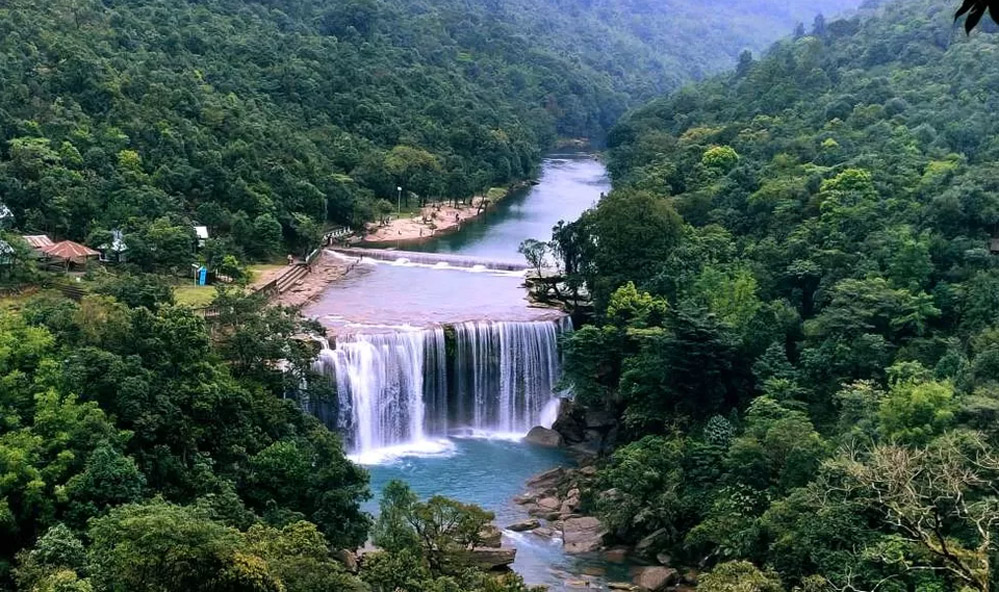
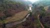
Deep within the emerald forests of South Garo Hills lies a natural wonder that seems almost too spectacular to be real. Wari Chora, recently discovered and still largely unexplored, is rapidly becoming one of Meghalaya's most captivating destinations. This breathtaking river canyon, carved over centuries by the Rongdik River, offers visitors an experience that transcends ordinary tourism—it's a journey into a realm where nature's artistry meets ancient folklore.

For travelers based in Shillong, Wari Chora represents the ultimate offbeat adventure, located approximately 285 kilometers away in a region where modernity gracefully surrenders to pristine wilderness.

The Legend of the Seven Giant Serpents

In the Garo language, 'Wari' translates to "deep water," while 'Chora' means "long"—together describing a place surrounded by towering canyons with tranquil waters flowing through. But there's more to this name than simple geography.

Local legends speak of seven giant serpents that protect Wari Chora's pristine waters and surrounding wilderness. According to Garo folklore, anyone who disrespects the river or its ecosystem will incur the wrath of these mystical guardians. This belief has ensured that the local communities maintain a deep reverence for nature, keeping the area remarkably unspoiled.

Some locals also whisper tales of a beautiful mermaid who occasionally appears in the waters, adding to the canyon's enchanting mystique. Whether myth or reality, these stories reflect the profound spiritual connection the Garo people have with their land.

A Geological Masterpiece

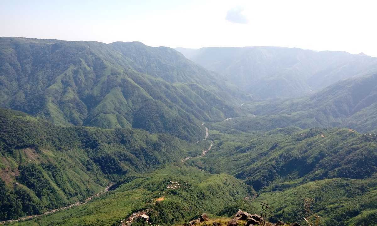
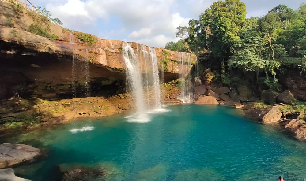
Wari Chora Canyon is a testament to nature's patient craftsmanship. Formed by centuries of weathering and erosive activities of the Rongdik River, the canyon features towering cliffs that reach approximately 45 feet deep, with the river trail extending about 500 meters. The canyon walls, draped in vibrant moss and vegetation, create layers that remarkably resemble coiled serpents—perhaps giving physical form to the legendary seven protectors. 

The Rongdik River itself is a tributary of the Simsang River and historically served as a crucial waterway for transporting people and goods between Meghalaya and Bangladesh. Though the river's course has changed over time, its legacy as a lifeline for local communities endures.

The waters of Wari Chora shift through an incredible spectrum of colors—teal, turquoise, jade, and crystal clear—depending on the sunlight's angle and the depth of the water. Combined with the ochre and orange hues of the canyon walls, the visual experience is nothing short of magical.

The Adventure Awaits: What to Experience

1. Canyon Kayaking & Rafting

The highlight of any Wari Chora visit is the immersive kayaking or rafting experience through the narrow canyon. As you glide through the crystal-clear waters, towering moss-covered cliffs rise on either side, creating an almost otherworldly atmosphere. The gentle current allows for a peaceful journey, perfect for both beginners and experienced paddlers.

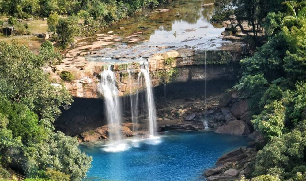
2. The Rainbow Waterfall

Perhaps the most enchanting feature of Wari Chora is a waterfall hidden within the canyon. Local guides know that at precisely 12:30 PM, when the sun's rays hit the waterfall at the perfect angle, a stunning rainbow appears at its base—a phenomenon that leaves visitors spellbound.

3. Jungle Trekking

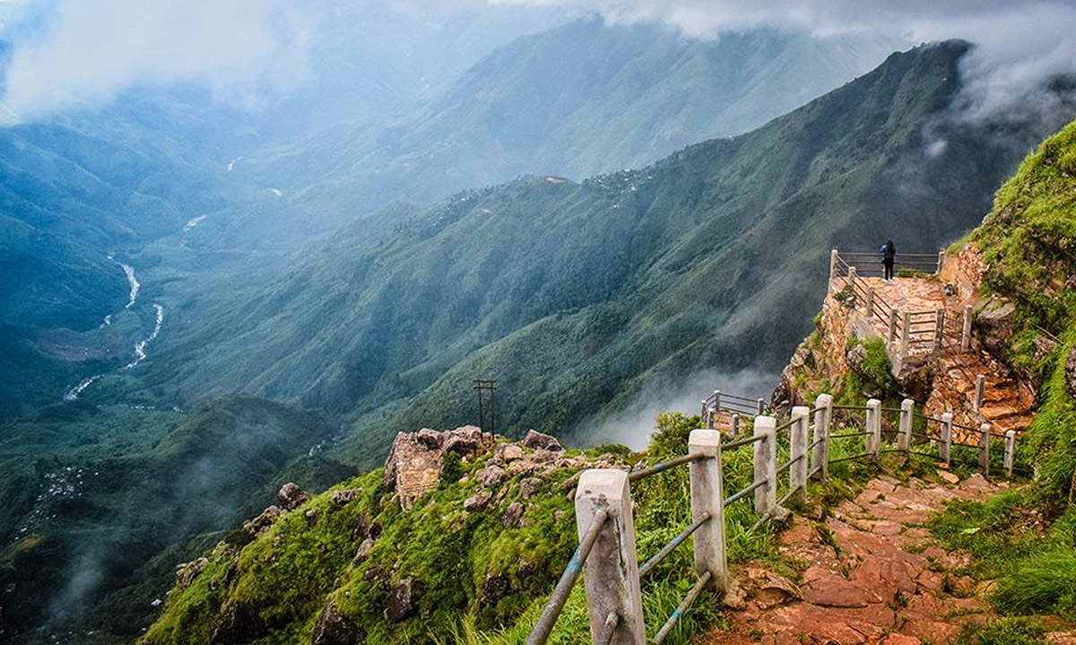
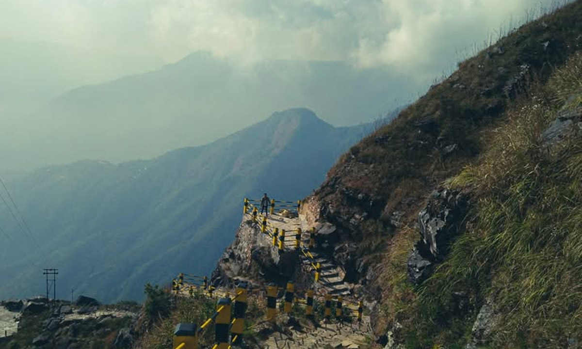
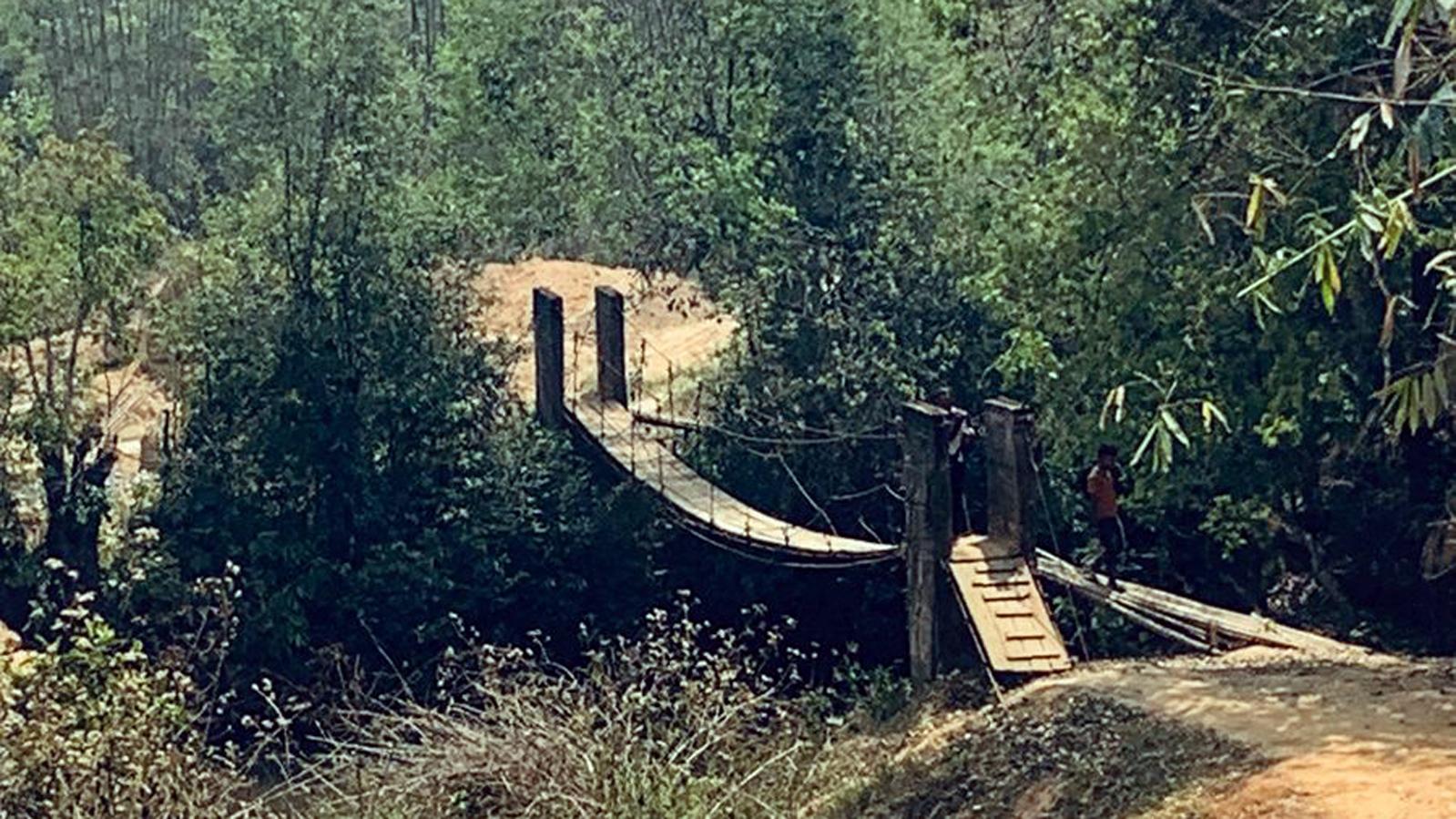
The journey to Wari Chora is an adventure in itself. From the designated parking area, visitors embark on approximately a 1.5 to 2-hour trek through dense forest trails. The descent to the riverbank covers about 3-5 kilometers through jungle paths, with the trek becoming progressively steeper. Some sections require crawling through narrow passages, and ropes are positioned at tricky spots to assist trekkers.

4. Wildlife & Nature Photography

The surrounding forests are rich in biodiversity. While trekking, keep your eyes open for various bird species, unique flora, and if you're lucky, glimpses of the region's wildlife. The interplay of light filtering through the dense canopy creates spectacular photography opportunities.

5. Cultural Immersion

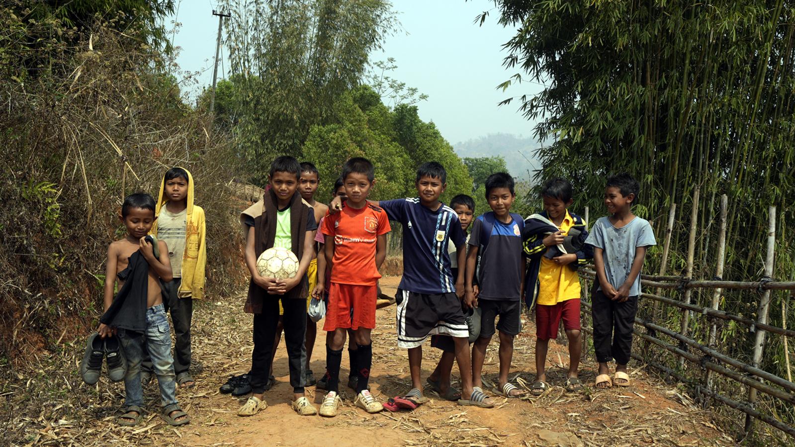
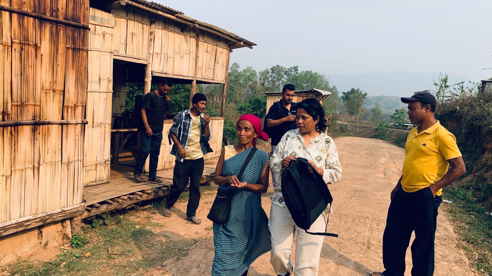
Nearby villages like Emangre and Dabalgre offer authentic homestay experiences where visitors can learn about Garo culture, traditions, and their harmonious relationship with nature.

Planning Your Visit: Practical Information

Location

Wari Chora is situated in Rekmangre Village, between Pharomgre and Emangre villages in the South Garo Hills District. The nearest major town is Baghmara, which serves as the gateway to this hidden paradise.

How to Reach from Shillong

  • Distance: Approximately 285 km from Shillong
  • Route: Shillong → Tura (main town of Garo Hills) → Baghmara (110 km from Tura) → Emangre
  • By Air: Nearest airports are Shillong Airport (296 km) and Guwahati Airport (219 km)
  • By Rail: Nearest railway station is Dudhnoi in Goalpara, Assam

Important Note: Google Maps may not provide accurate routes beyond Tura. It's highly recommended to hire local guides from Baghmara or Emangre and avoid relying solely on GPS navigation.

Best Time to Visit

November to April is ideal for visiting Wari Chora. During these months:

  • Weather remains cool and dry
  • Trekking trails are in optimal condition
  • Water levels are manageable for kayaking
  • Minimal rainfall ensures better visibility

Avoid monsoon season (June-September) when:

  • Trails become slippery and treacherous
  • Leeches are abundant in the forest
  • Heavy mist can obscure the canyon's beauty
  • Water currents may be too strong

Where to Stay

Emangre Village Homestay offers basic but comfortable accommodation:

  • Private rooms: ₹700 per bed (2 persons can share)
  • Two-person tent: ₹500 per tent
  • Includes authentic Garo meals
  • Hosts can arrange local guides and transportation

Dabalgre village also has homestay options for travelers seeking alternative accommodations.

Essential Requirements

  • Local Guide: Mandatory—trails are unmarked and require local knowledge
  • Physical Fitness: Moderate level required for 1-2 hour treks
  • 4x4 Vehicle: From Emangre, a 15 km off-road journey is necessary to reach the trek starting point
  • Permits: Check with local authorities or your guide about any required permits

What to Pack

Waterfall inside Wari Chora canyon

Must-Haves:

  • Sturdy trekking shoes with good grip
  • Comfortable, quick-dry clothing
  • Rain jacket (even in dry season)
  • Waterproof bag for electronics
  • Swimming attire (if you plan to swim)
  • Sun protection (hat, sunscreen)
  • Insect repellent or salt (for leech protection)
  • First aid kit
  • Sufficient drinking water and energy snacks
  • Camera/GoPro for capturing memories

Monsoon Season Additional Items:

  • Extra deodorant spray or sanitizer (deters leeches)
  • Multiple pairs of socks
  • Waterproof hiking boots
  • Poncho or full rain gear

Safety & Responsible Tourism

Respect the Land of Seven Serpents

Whether you believe in the legends or not, respecting Wari Chora's environment is paramount:

  • Leave no trace: Carry all waste back with you
  • No littering: The river and forest must remain pristine
  • Respect wildlife: Observe from a distance, never disturb
  • Follow guide instructions: They know the terrain and weather patterns
  • Support local communities: Purchase from local vendors, respect cultural norms

Trekking Safety

  • Never trek without a local guide
  • Inform someone about your trekking plans
  • Trek during daylight hours only
  • Stay hydrated throughout the journey
  • Take breaks as needed—the ascent can be challenging

Beyond Wari Chora: Nearby Attractions

Make your Garo Hills journey more comprehensive by exploring:

Siju Caves

Located near Wari Chora, these limestone caves are among India's longest cave systems, featuring stunning stalactite and stalagmite formations.

Balpakram National Park

Known as the "Land of Spirits," this mystical plateau offers unique flora, fauna, and breathtaking viewpoints.

Nokrek Biosphere Reserve

A UNESCO Biosphere Reserve home to rare red pandas, elephants, and the endangered hoolock gibbons.

Fish Sanctuaries

  • Aginma in Emangre village
  • Jadesil in Tolegre village

Both sanctuaries protect endangered Redfins and Golden Mahseers fish species in pristine, pollution-free waters.

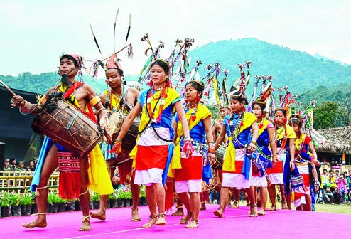
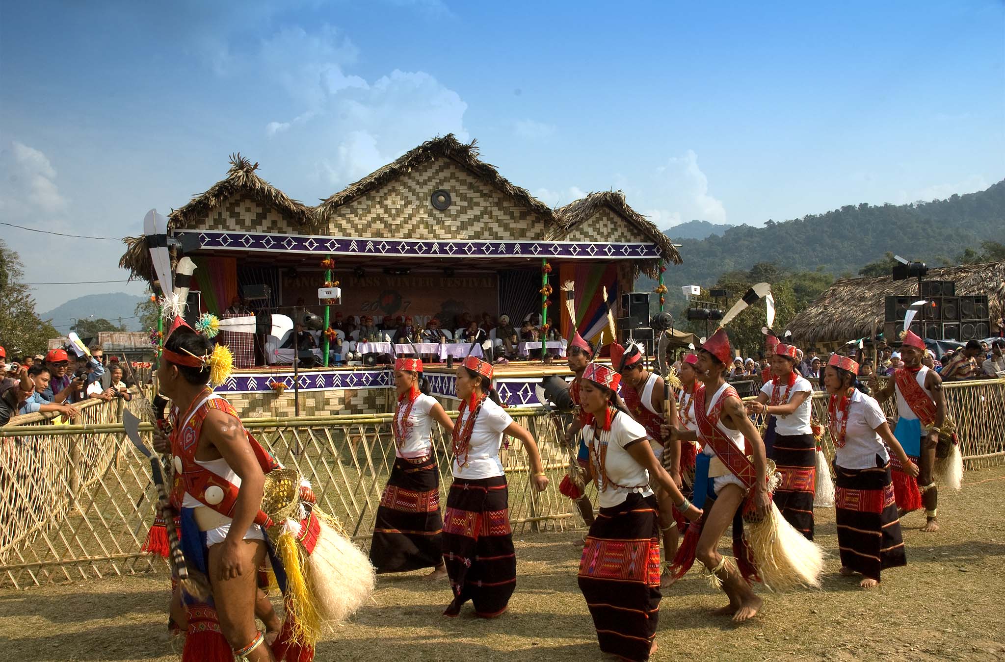
The Garo Cultural Experience

The Garo people, or A·chiks as they call themselves, are one of Northeast India's most fascinating indigenous communities. Visiting Wari Chora offers a unique opportunity to:

  • Witness traditional Garo architecture
  • Sample authentic Garo cuisine featuring local ingredients
  • Learn about their matrilineal society
  • Experience their famous hospitality
  • Understand their sustainable living practices

If you're fortunate to visit during festival season, the Wangala (100 Drums Festival) in November is a spectacular celebration of Garo culture and harvest traditions.

Photography Tips

To capture Wari Chora's ethereal beauty:

  1. Golden Hour: Arrive early to capture the morning light filtering through the canyon
  2. The Rainbow Shot: Be ready at 12:30 PM near the waterfall
  3. Waterproof Equipment: Essential for kayaking photography
  4. Wide-Angle Lens: Captures the canyon's towering scale
  5. Polarizing Filter: Enhances water clarity and reduces reflections
  6. GoPro/Action Camera: Perfect for water-level perspectives during kayaking

Sustainable Tourism: Preserving Paradise

Wari Chora's recent discovery means tourism infrastructure is still developing. This presents both an opportunity and a responsibility:

Current Challenges:

  • Limited accommodation options
  • No mobile network coverage in many areas
  • Minimal waste management facilities
  • Fragile ecosystem vulnerable to over-tourism

How You Can Help:

  • Travel in small groups
  • Book through responsible tour operators
  • Support local homestays and guides
  • Carry reusable water bottles and containers
  • Educate fellow travelers about responsible practices
  • Share your experiences to promote awareness, not exploitation

The local Garo community has taken the initiative to manage tourism sustainably. By respecting their guidelines and supporting their efforts, we can ensure that Wari Chora remains a paradise for generations to come.

Trip Planning Checklist

Before You Go:

  • Book homestay accommodation in Emangre/Dabalgre
  • Arrange local guide through homestay
  • Confirm 4x4 vehicle availability for off-road section
  • Check weather forecast
  • Pack appropriately for season
  • Inform family/friends of travel plans
  • Download offline maps (as backup)
  • Ensure travel insurance coverage

Budget Estimate (Per Person):

  • Accommodation: ₹500-700/night
  • Local guide: ₹500-1,000/day
  • 4x4 vehicle: ₹1,500-2,000 (shared)
  • Kayaking/rafting equipment: ₹300-500
  • Meals: ₹200-300/day
  • Total (excluding transportation to Garo Hills): ₹3,000-5,000

Why Wari Chora Should Be on Your Bucket List

In an age where true wilderness is increasingly rare, Wari Chora offers something precious: an authentic encounter with untamed nature. Here's what makes it unmissable:

  1. Unparalleled Natural Beauty: The canyon's colors, formations, and pristine waters create scenes that seem almost surreal
  2. Adventure & Serenity Combined: From challenging treks to peaceful kayaking, it offers varied experiences
  3. Cultural Immersion: Genuine interaction with Garo communities and their sustainable lifestyle
  4. Off-the-Beaten-Path: Still relatively unknown, offering solitude rare in popular tourist spots
  5. Photographic Paradise: Every angle offers Instagram-worthy shots
  6. Spiritual Connection: The legends and environment create a deeply moving experience

Many visitors describe Wari Chora as a place that cannot be fully captured in words or photographs—it must be experienced. The profound sense of awe and connection with nature stays with you long after you leave.

Final Thoughts: The Journey is the Destination

Reaching Wari Chora requires commitment—bumpy roads, challenging treks, basic accommodations, and disconnection from digital life. But as countless visitors attest, what awaits at the end is nothing short of transformative.

This is not a destination for those seeking luxury or convenience. Wari Chora is for the adventurous spirit, the nature lover, the seeker of authentic experiences. It's for those willing to step outside their comfort zone to witness one of nature's most magnificent creations.

As you stand in the canyon, kayak in hand, with towering cliffs on either side and crystal-clear waters beneath you, the legend of the seven giant serpents suddenly doesn't seem so far-fetched. In that moment, you understand why the Garo people hold this place sacred.

Wari Chora isn't just a tourist destination—it's a reminder of the magic that still exists in our world, waiting to be discovered by those brave enough to seek it.


Quick Reference Guide

DetailInformation
LocationRekmangre Village, South Garo Hills, Meghalaya
Distance from Shillong285 km (approximately 7-8 hours)
Best TimeNovember to April
Trek Duration1-2 hours descent, 1.5-2.5 hours ascent
Trek DifficultyModerate (some technical sections)
Local GuideMandatory
AccommodationHomestays in Emangre/Dabalgre (₹500-700/night)
Mobile NetworkLimited/None in remote areas
Entry FeeVaries (confirm with local guides)


Contact Information for Planning

  • Meghalaya Tourism: Official Website
  • Local Homestays: Contact through tourism offices in Baghmara
  • Emergency: Keep nearest hospital/police station numbers handy
  • Weather Updates: Check Baghmara forecasts before traveling


Start Your Adventure

Wari Chora awaits, with its seven serpents standing guard over one of Meghalaya's most extraordinary hidden treasures. Will you answer the call of the canyon?

Book your journey to the Land of Seven Giant Serpents today and become part of a legend that's still being written.


Have you visited Wari Chora? Share your experiences and tips in the comments below to help fellow travelers discover this magical destination responsibly!

Article researched and compiled January 2026 | All information verified through official tourism sources and recent traveler accounts

Shyntor Fest 2025

Shyntor festival 2025 Meghalaya 
Shyntor Festival 2025

Welcome to the inaugural Shyntor Festival 2025 — a celebration of music, culture, community, and nature nestled in the heart of Meghalaya. Hosted in the serene village of Shyntor Bulia — where two rivers meet and the hills echo with stories — this three-day, three-night experience (December 11–13, 2025) brings together the spirit and soul of Northeast India.

A portion of the proceeds will directly support the local Khasi community of Shyntor Bulia, home to just 64 households. Your participation helps enhance rural education, livelihoods, and infrastructure.

What to Expect

Live Music & Performances
  • Local bands from Meghalaya & Northeast India
  • Guest acts from other parts of India
  • Folk, fusion, acoustic, and jam sessions
  • Open-mic & jam spaces — bring your instrument, voice, or art
Cultural Showcases
  • Traditional Khasi music & dance performances
  • Handloom, bamboo crafts, and handmade souvenirs
Food & Local Cuisine
  • Tribal-style dinners and curated village feasts
  • Homestyle meals by villagers & ethnic food stalls
  • Local rice beer and beverages
  • Breakfast, lunch, and dinner included for campers

Stay & Amenities

Tent Accommodation

Included with select passes — enjoy a 2-night camping experience.

Basic Amenities

Safe drinking water, sanitation, and wash zones available on-site.

Evening Activities

Bonfires, stargazing, and community evenings under the open sky.

Note: The terrain is rough—this event is not recommended for elderly attendees or persons with mobility challenges.

Activities & Explorations

  • Guided hill walks & nature trails
  • Visits to nearby waterfalls & bird sanctuary
  • Farm & orchard tours with local growers
  • Forest foraging walks with herbal experts
  • Craft demonstrations — bamboo weaving, handloom
  • Tribal cooking workshops
  • Fireside storytelling & cultural exchange
  • Photography walks with village guides

Getting There

Shyntor Bulia is a remote Khasi tribal village (~450 residents).

Nearest vehicle drop is 1 km from the venue—accessible only by walking.

Approximately 30 km from Nongpoh or Umnshning via NH6 (Guwahati–Shillong highway).

In winter, riverbeds can be crossed on foot; in summer, access is via a footbridge.

Calling All Performers & Artists

This is an open-hearted festival — and your creativity is welcome! Whether it's music, art, dance, poetry, or storytelling, you're invited to showcase your talent. Contact us if you’d like to pre-register your performance or set up an art space.

Organisers & Partners

Organised by: Rongjeng Welfare Foundation, Shyntor Bulia, Meghalaya

Local Hosts: Villagers of Shyntor Bulia & Pamrinai

Partners:

Rural Women Upliftment Society (RWUS), Manipur

Jambul Café, Bar & Stay, Goa

Rongjeng Technologies, Assam

Asian Holidays & Asian Expeditions, Guwahati

Art & Curation: Ganesh Gohain • Photography: Surajit Sharma, Guwahati

Research & Advisory: Mosaic Bowl (PR), Bangalore

Date
Location/Venue
Event Date
-

CHANGLANG

CHANGLANG
CHANGLANG
CHANGLANG

Changlang, a place of picturesque hills and rivers in Arunachal Pradesh occupies a prominent place the country’s tourism map. The beautiful district in the land of rising sun along the Indo-Myanmar border turns into a dreamscape for the tourists when the rising sunshine kisses the eastern mountain ranges. Literally, the word “Changlang” came from “Changlangkan”, a hilltop known for the herb used to poison the river fish. Hemmed in by Lohit district in the north, the place of exotic natural beauty has Tirap district in the west. Myanmar is situated in the South East side bounded by the Patkai Bum hills.

Changland is also called a river district in the frontier state where Noa-Dehing, Namchik, Tirap, Namphuk, Dapha, Namphai, Tissu, Tarit, Tara, Tikeng and Tiging merge with the river Buri-Dihing. The entire district is proud of its rich flora and fauna as the huge area is covered with semi-evergreen forests apart from Himalayan broadleaf forests. The beauty is further accentuated by the mountain slopes with alpine not to speak of the thickening rhododendron, oak, pine, maple, fir, juniper et al.

The entire district of 4,662 square km is populated by 1,48,226 persons and the inhabitants here, mostly, are Tutsa, Tangsa, Nocte, Singpho and the Lisu tribes. They are apart from some other tribes which include Deoris, Tibetans and Chakma and Hajong refugees. The Tangsas founded their safe abode in the south-eastern Patkai Bum hills along the international border. But the Singphos reside on the plains while the Tutsas are available in the western part. These tribal people can fluently speak Tangsa, Assamese, Hindi and English.

One of the must see spots in Changlang is the World War cemetery. Foreign tourists often find it very interesting to visit the place to revive the memory of the wars where hundreds of dead soldiers are still living in the hearts of millions of the people. Most of these soldiers are believed to have come from China, UK, US.

A lake in the Changlang district often leaves many tourists in utter mystery. Popularly known as the Lake of No Returns, it is nothing but a water body of a stunning view.

The main festivals here include Moh-Mol, Pongtu Kuh and Shapawng Yang Manu Poi. These are usually celebrated by the Tangsa, Tutsa and Singpho tribes where the tourists make it an occasion to enjoy the tradition, art and culture of these colourful tribal people. The best time to visit Changlang is November to February where the roads from Dibrugarh, Tinsukia, Margherita and Miao remain fine and wonderful. The tourists who come by air need to land in Dibrugarh airport while those who come by train and bus must land in Tinsukia en route to this enchanting tourist spot in Arunachal Pradesh.

How to reach: 

Air:  Changlang township is 136 km from the nearest Airport at Mohanbari, Dibrugarh, Assam.

Rail:  It is 96 km from the nearest long distance Railway station Tinsukia Railway Station, Assam. And 45 km from the nearest Passenger Railway station, Margherita Railway Station, Assam.

Road:  Good motorable road is connected up to Changlang township. It is 140 km from Dibrugarh, 95 km from Tinsukia, 44 km from Margherita and 110 km from Miao

Date
Location/Venue

Shyntor Bulia village

Socio-Economic Profile of the Villages: Shyntor Bulia, Syntiewmaw, Kynjoin, Mawlaho, and Pamrynai

Overview

These villages, located in the Umsning Block of Ri-Bhoi District, Meghalaya, share a common rural character, with agriculture as the primary occupation. Despite their small size, they have basic educational facilities provided by SSA schools.

Help build Green Leaves LP School in Shyntor Bulia Village, Meghalaya

Key Socio-Economic Indicators

VillageHouseholdsPopulationLiteracy RateMain OccupationEducational FacilitiesOther Activities
Shyntor Bulia6444880%Agriculture2 SSA schools (up to class V)N/A
Syntiewmaw50250N/AAgriculture, Handloom & Handicraft1 SSA schoolWeaving
Kynjoin22154N/AAgriculture1 SSA schoolN/A
Mawlaho120550N/AAgriculture1 SSA schoolWeaving, Silkwork
Pamrynai105650N/AAgriculture1 SSA schoolN/A

Common Challenges and Opportunities

  • Geographic Isolation: The villages, especially Shyntor Bulia due to the seasonal flooding, face challenges in connectivity and accessibility.
  • Educational Limitations: The SSA schools only provide education up to class V, limiting educational opportunities for students beyond that level. At Shyntor Bulia, the villagers setup a private school since the  SSA school is far away from their village.
  • Limited Infrastructure: The villages lack basic infrastructure such as proper roads, healthcare facilities.
  • Economic Diversification: Dependence solely on agriculture makes the villages vulnerable to fluctuations in crop yields and market prices.
  • Opportunities in Handicrafts: The weaving and silkwork activities in Syntiewmaw and Mawlaho could be promoted and scaled up to provide alternative sources of income. Central Silk Board has their office at Nongpoh and working in these areas promoting adoption Muga silk as livelihood option.

Recommendations

  • Improved Infrastructure: Government initiatives should focus on improving roads, bridges, and other infrastructure to enhance connectivity and accessibility.
  • Upgradation of Education: The SSA schools could be upgraded to provide education up to higher levels or explore alternative educational models like distance learning.
  • Promotion of Handicrafts: The government and NGOs could provide training, marketing support, and access to finance for artisans engaged in weaving and silkwork.
  • Diversification of Agriculture: Farmers could be encouraged to adopt sustainable agricultural practices, explore value-added products, and diversify their crops.
  • Community Development Programs: Implementing community development programs can address social and economic challenges, improve livelihoods, and strengthen community resilience.

By addressing these challenges and leveraging the opportunities, these villages can improve their socio-economic conditions and enhance the quality of life of their residents.


children with football
Shyntor Bulia's Football field, located next to 2 small rivers
The river
Shyontor Biulia village
Shyntor Bulia's Football field, located next to 2 small rivers
in ront of a village restautant
Governemnt primary school at Shyntor Bulia
Office of the Rongjeng Welfare Foundation
The suspension foot bridge over a small river that connectes teh vuillage with mainland
children with football
Shyntor Bulia's Football field, located next to 2 small rivers
The river
The river
Shyontor Biulia village
Shyntor Bulia's Football field, located next to 2 small rivers
in ront of a village restautant
Governemnt primary school at Shyntor Bulia
Office of the Rongjeng Welfare Foundation
The suspension foot bridge over a small river that connectes teh vuillage with mainland

Arunachal Odyssey: A Deep Dive into the Himalayan Wilderness

This 15-day expedition promises an immersive journey through the heart of Arunachal Pradesh, a region renowned for its pristine landscapes, rich cultural tapestry, and unparalleled adventure. From the verdant valleys of Ziro to the rugged heights of the Mechuka Valley, this itinerary is a symphony of nature, culture, and exploration.

Itinerary Highlights

Tags

A Birder’s Paradise: Arunachal Pradesh

Arunachal Pradesh, India’s northeastern frontier, is a birder’s dream. This remote and largely unexplored region is a treasure trove of avian diversity, home to a staggering array of endemic and migratory species. From the lush valleys of the Brahmaputra to the towering peaks of the Himalayas, the state offers a unique opportunity to witness nature’s spectacle in all its glory.

Tags

Shillong Dotcom brings news, views, business, tourists into one platform.  

Address: Shillong Dotcom, c/o: Online Tent Service Centre, Pynthorbah Block 2 Church Street Shillong - 793001, Meghalaya. INDIA.

For inquiries, collaboration, please contact us at: office@shillong.com, sam@shillong.com. Phone: 6033091345.